
Services
Topographic Surveys
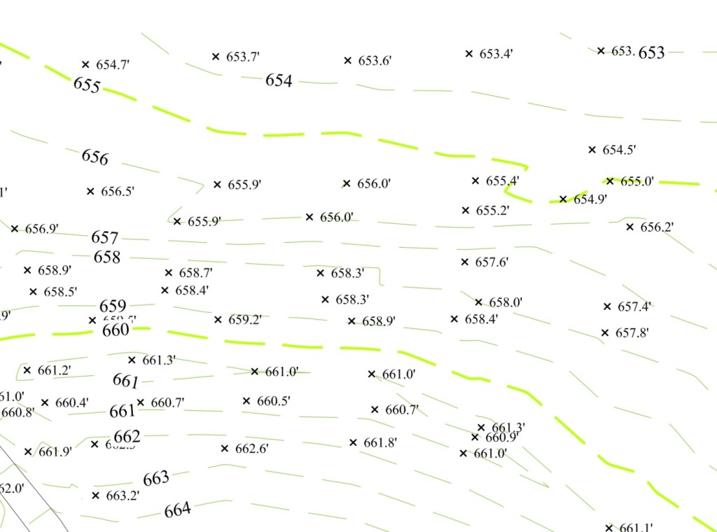
Topographic surveying is the method of determining the positions, on the surface of the earth, of human made and natural features. It also is used to determine the configuration of the terrain. The purpose of a topographic survey is to gather spatial information relating to the site (natural and man-made land features).
Topographic surveys are typically carried out when an area is being assessed for new construction or the addition of new development. The survey is invaluable for showing what the land looks like now, and how it will impact design and construction.
Subdivision Platting
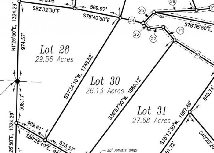
Platting is the process through which a parcel of property is subdivided into legal lots or tracts of land. Applications for the subdivision of land must be submitted to the Subdivision Administrator by a Surveyor registered in the State of Texas. This is not something a property owner can do on their own.
A licensed surveyor will combine research of existing documents with a physical survey of the land in order to create a subdivision plat. The completed plat shows the divisions of the larger piece of land, as well as the distance and bearings between each corner of land.
Usually, the creation of a subdivision plat is done by a land surveyor who has been hired by the developer who intends to upon the land once the plat is approved. This developer may be the original owner of the land or an individual or company who has purchased the land strictly for the purpose of subdividing it.
ALTA/NSPS Land Title Survey
An ALTA/NSPS Land Title Survey is a complex survey product designed to assist all parties involved in a real estate transaction. Whether being used by the title insurer to delete or determine exceptions, or by the buyer and seller to assess potential risk, it is a comprehensive product that allows for a detailed view of an existing property.
The ALTA Survey is a detailed map of the land showing all existing improvements of the property, utilities, and significant observations within the insured estate. The survey details the surveyor’s findings concerning the property boundaries and how it relates to title.

As-Built Survey / Final Survey
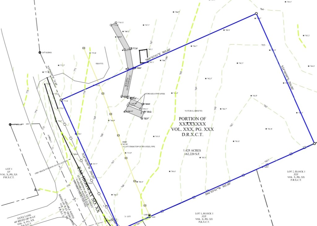
Many communities require a Final Grade Survey before the issuance of a Certificate of Occupancy. The builder/owner is required to submit an accurate survey for the lot, including the following: All one-foot contour lines, all topography, all inlets, catch basins, cleanouts, and associated piping. All site features inclining swales, retaining walls, drainage infrastructures, the elevation of all drainage breakpoints, and drainage patterns within the lot. This survey is also known as As-Built/Final Survey. It is carried out during or immediately after the construction is finished. The Final Grade Survey is often presented as an overlay over existing design plans for direct comparison with design information
An As-Built survey is a record of location of the improvements “as they are built” during construction. The final location of construction improvements such as sewer pipes, buildings, utilities and pavement can be different than the original design location. Unforeseeable difficulties during construction may have required changes in the field to the original design. An As-built survey is a set of record drawings of the final location of the field changes for future reference.

AERIAL MAPPING (DRONE)
The process of aerial surveying starts with collecting high-altitude photos of a plot of land using a plane or drone. While traditional surveying methods require meticulous measurement, preparation, and planning, drones can capture comparable data in dramatically shorter timeframes.
